Mapping the Clark Family
My map of Meigle parish in Perthshire 2022
I went to Brighton, England in November 2022 to take lessons in hand-drawn map-making with artist Helen Cann (https://helencann.co.uk)
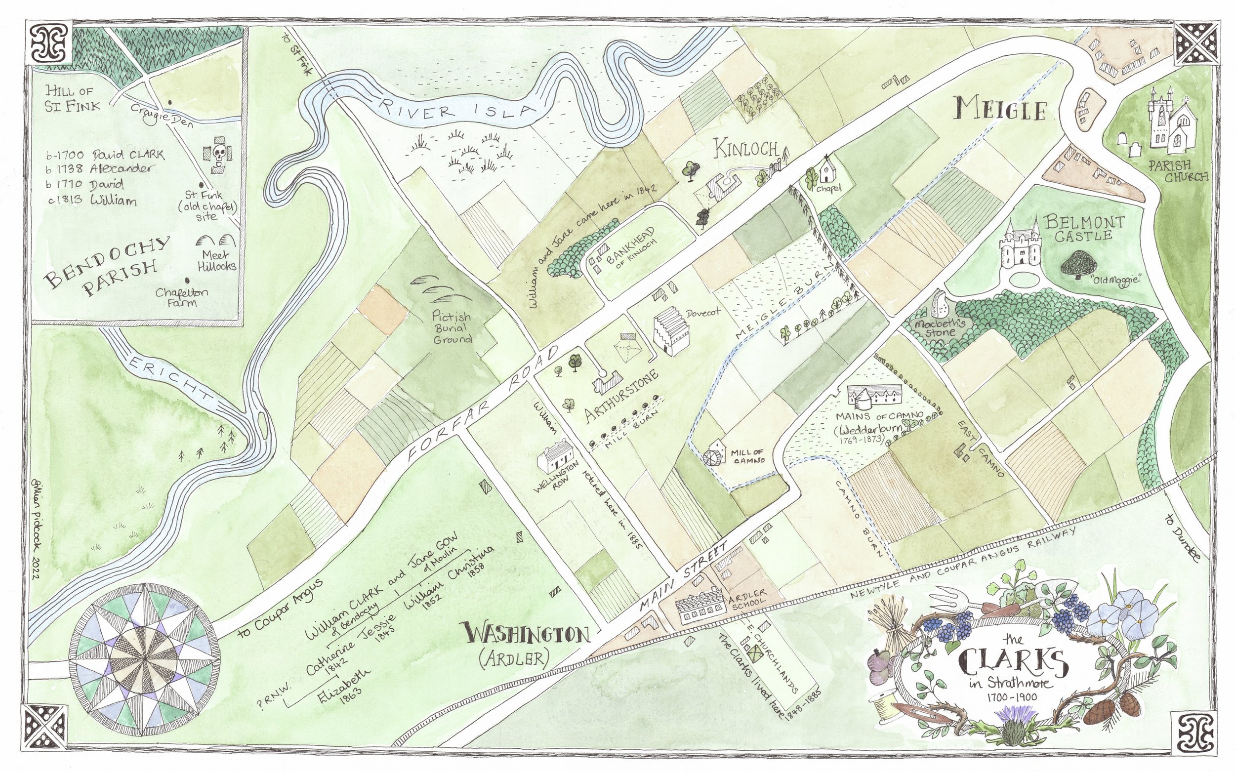
My goal was to make a map of the Meigle area showing where the Clark and Wedderburn families lived. As you know by now my great grandmother Elizabeth Clark 1863 was the illegitimate child of Catherine Clark 1842 and Robert Wedderburn 1831.
When I talked to Helen before I went I showed her my preliminary map of Leith showing my mum’s family - where they lived; their occupations etc.. It was a big complicated map and we decided that something more simple would be easier to tackle in the three days we had together. So I decide to show where the Clark family lived in Strathmore.
Day One: I figured out which area I wanted to show and scaling a map to fit my paper. I brought with me an 1865 map of the Meigle area which I used to show the roads back then. (They haven’t changed much). I drew roads and waterways in pencil and decided where the cartouche and compass rose would go. I also needed an inset map to show where the early Clarks lived as it was to the north and west of Meigle in Bendochy Parish.
Day Two: I inked in the roads, river, and buildings and made a “neat line” (border).
Day Three: I learned how to use watercolor to color the map.
“The map is not the territory”
Every map is subjective and shows what the map-maker chooses. I wanted to show the history of six generations of Clarks in the Strathmore valley - where they lived and what the area was like.